Port-Au-Prince
Port-au-Prince is the capital and most populous city of Haiti. The city’s population was estimated at 987,310 in 2015 with the metropolitan area estimated at a population of 2,618,894. The metropolitan area is defined by the IHSI as including the communes of Port-au-Prince, Delmas, Cite Soleil, Tabarre, Carrefour, and Pétion-Ville.
The city of Port-au-Prince is on the Gulf of Gonâve: the bay on which the city lies, which acts as a natural harbor, has sustained economic activity since the civilizations of the Arawaks. It was first incorporated under French colonial rule in 1749. The city’s layout is similar to that of an amphitheatre; commercial districts are near the water, while residential neighborhoods are located on the hills above. Its population is difficult to ascertain due to the rapid growth of slums in the hillsides above the city; however, recent estimates place the metropolitan area’s population at around 3.7 million, nearly half of the country’s national population. The city was catastrophically affected by a devastating earthquake in 2010, with large numbers of structures damaged or destroyed. Haiti’s government estimated the death toll to be 230,000.
Etymology: It is said that a captain named de Saint-André named the area in 1706, after he sailed into the bay in a ship named Le Prince, hence Port-au-Prince to mean, “Port of the Prince.” However, the port and the surrounding region continued to be known as Hôpital, but the islets in the bay had already been known as Les îlets du Prince as early as 1680. French colonial commissioner Étienne Polverel named the city Port-Républicain on 23 September 1793 “in order that the inhabitants be kept continually in mind of the obligations which the French Revolution imposed on them.” It was later renamed back to Port-au-Prince by Jacques I, Emperor of Haiti.
When Haiti was divided between a kingdom in the north and a republic in the south, Port-au-Prince was the capital of the republic, under the leadership of Alexandre Pétion. Henri Christophe renamed the city Port-aux-Crimesafter the assassination of Jacques I at Pont Larnage (now known as Pont-Rouge, and located north of the city).
Spanish colonization: Prior to the arrival of Christopher Columbus, the island of Hispaniola was inhabited by people known as the Taíno, who arrived in approximately 2600 BC in large dugout canoes. They are believed to come primarily from what is now eastern Venezuela. By the time Columbus arrived in 1492 AD, the region was under the control of Bohechio, Taíno cacique (chief) Xaragua. He, like his predecessors, feared settling too close to the coast; such settlements would have proven to be tempting targets for the Caribes, who lived on neighboring islands. Instead, the region served as a hunting ground. The population of the region was approximately 400,000 at the time, but the Taínos were gone within 30 years of the arrival of the Spaniards.
With the arrival of the Spaniards, the Amerindians were forced to accept a protectorate, and Bohechio, childless at death, was succeeded by his sister, Anacaona, wife of the cacique Caonabo. The Spanish insisted on larger tributes. Eventually, the Spanish colonial administration decided to rule directly, and in 1503, Nicolas Ovando, then governor, set about to put an end to the régime headed by Anacaona. He invited her and other tribal leaders to a feast, and when the Amerindians had drunk a good deal of wine (the Spaniards did not drink on that occasion), he ordered most of the guests killed. Anacaona was spared, only to be hanged publicly some time later. Through violence and murders, the Spanish settlers decimated the native population.
Direct Spanish rule over the area having been established, Ovando founded a settlement not far from the coast (west of Etang Saumâtre), ironically named Santa Maria de la Paz Verdadera, which would be abandoned several years later. Not long thereafter, Ovando founded Santa Maria del Puerto. The latter was first burned by French explorers in 1535, then again in 1592 by the English. These assaults proved to be too much for the Spanish colonial administration, and in 1606, it decided to abandon the region.
Domination of the flibustiers: For more than 50 years, the area that is today Port-au-Prince saw its population drop off drastically, when some buccaneers began to use it as a base, and Dutch merchants began to frequent it in search of leather, as game was abundant there. Around 1650, French pirates, or flibustiers, running out of room on the Île de la Tortue began to arrive on the coast, and established a colony at Trou-Borded. As the colony grew, they set up a hospital not far from the coast, on the Turgeau heights. This led to the region being known as Hôpital.
Although there had been no real Spanish presence in Hôpital for well over 50 years, Spain retained its formal claim to the territory, and the growing presence of the French flibustiers on ostensibly Spanish lands provoked the Spanish crown to dispatch Castilian soldiers to Hôpital to retake it. The mission proved to be a disaster for the Spanish, as they were outnumbered and outgunned, and in 1697, the Spanish government signed the Treaty of Ryswick, renouncing any claims to Hôpital. Around this time, the French also established bases at Ester (part of Petite Rivière) and Gonaïves.
Ester was a rich village, inhabited by merchants, and equipped with straight streets; it was here that the governor lived. On the other hand, the surrounding region, Petite-Rivière, was quite poor. Following a great fire in 1711, Ester was abandoned. Yet the French presence in the region continued to grow, and soon afterward, a new city was founded to the south, Léogane.
While the first French presence in Hôpital, the region later to contain Port-au-Prince was that of the flibustiers; as the region became a real French colony, the colonial administration began to worry about the continual presence of these pirates. While useful in repelling Englishmen intent on encroaching upon French territory, they were relatively independent, unresponsive to orders from the colonial administration, and a potential threat to it. Therefore, in the winter of 1707, Choiseul-Beaupré, the governor of the region sought to get rid of what he saw as a threat. He insisted upon control of the hospital, but the flibustiers refused, considering that humiliating. They proceeded to close the hospital rather than cede control of it to the governor, and many of them became habitans (farmers) the first long-term European inhabitants in the region.
Although the elimination of the flibustiers as a group from Hôpital reinforced the authority of the colonial administration, it also made the region a more attractive target for the English. In order to protect the area, in 1706, a captain named de Saint-André sailed into the bay just below the hospital, in a ship named Le Prince. It is said that M. de Saint-André named the area Port-au-Prince (meaning “Port of the Le Prince“), but the port and the surrounding region continued to be known as Hôpital, but the islets in the bay had already been known as les îlets du Prince as early as 1680.
The English did not trouble the area, and various nobles sought land grants from the French crown in Hôpital; the first noble to control Hôpital was Sieur Joseph Randot. Upon his death in 1737, Sieur Pierre Morel gained control over part of the region, with Gatien Bretton des Chapelles acquiring another portion of it.
By then, the colonial administration was convinced that a capital needed to be chosen, in order to better control the French portion of Hispaniola (Saint-Domingue). For a time, Petit-Goâve and Léogâne vied for this honor, but both were eventually ruled out for various reasons. Neither was centrally located. Petit-Goâve’s climate caused it to be too malarial, and Léogane’s topography made it difficult to defend. Thus, in 1749, a new city was built, Port-au-Prince.
Foundation of Port-au-Prince: In 1770, Port-au-Prince replaced Cap-Français (the modern Cap-Haïtien) as capital of the colony of Saint-Domingue.
In November 1791, it was burned in a battle between attacking black revolutionists and defending white plantation owners.
It was captured by British troops on June 4, 1794.
In 1804, it became the capital of newly independent Haïti.
American occupation: During the American occupation of Haiti (1915–1934), Port-au-Prince, garrisoned by American Marines and Haitian gendarmes, was attacked twice by caco rebels. The first battle, which took place in 1919, was a victory of the American and Haitian government forces, as was the second attack in 1920.
2010 earthquake: On 12 January 2010, a 7.0 earthquake struck Port-au-Prince, devastating the city. Most of the central historic area of the city was destroyed, including Haiti’s prized Cathédrale de Port-au-Prince, the capital building, Legislative Palace (the parliament building), Palace of Justice (Supreme Court building), several ministerial buildings, and at least one hospital. The second floor of the Presidential Palace was thrown into the first floor, and the domes skewed at a severe tilt. The seaport and airport were both damaged, limiting aid shipments. The seaport was severely damaged by the quake and was unable to accept aid shipments for the first week.
The airport’s control tower was damaged and the US military had to set up a new control center with generators to get the airport prepared for aid flights. Aid has been delivered to Port-au-Prince by numerous nations and voluntary groups as part of a global relief effort. On Wednesday, January 20, 2010, an aftershock rated at a magnitude of 5.9 caused additional damage.
Hurricanes: The worst hurricane season experienced by Haiti occurred in 2008 when four storms Fay, Gustav, Hanna and Ike negatively impacted Haiti. Nearly 800 people were killed; 22,000 homes were destroyed; 70% of the country’s crops were lost, according to reliefweb.org. Then, in 2012, Hurricane Sandy, while not making direct impact, resulted in 75 deaths, $250 million in damage and a resurgence of cholera that was estimated to infected 5,000 people.
Geography: The metropolitan area is subdivided into various communes (districts). There is a ring of districts that radiates out from the commune of Port-au-Prince. Pétion-Ville is an affluent suburban commune located southeast of the city. Delmas is located directly south of the airport and north of the central city, and the rather poor commune of Carrefour is located southwest of the city.
The commune harbors many low-income slums plagued with poverty and violence in which the most notorious, Cité Soleil, is situated. However, Cité Soleil has been recently split off from Port-au-Prince proper to form a separate commune. The Champ de Mars area has begun some modern infrastructure development as of recently. The downtown area is the site of several projected modernization efforts in the capital.
Demographics: The population of the area was 1,234,742. The majority of the population is of African descent, but a prominent biracial minority controls many of the city’s businesses. There are sizable numbers of Hispanic residents, Asians, as well as a number of Europeans (both foreign born and native born).
Citizens of Arab (particularly Syrian, Lebanese, and Palestinian) ancestry are a minority with a presence in the capital. Arab Haitians (a large number of whom live in Port-au-Prince) are, more often than not, concentrated in financial areas where the majority of them establish businesses. Most of the biracial residents of the city are concentrated within wealthier areas.
Economy: Port-au-Prince is one of the nation’s largest centers of economy and finance. The capital currently exports its most widely consumed produce of coffee and sugar, and has, in the past, exported other goods, such as shoes and baseballs. Port-au-Prince has food-processing plants as well as soap, textile and cement factories. Despite political unrest, the city also relies on the tourism industry and construction companies to move its economy. Port-au-Prince was once a popular place for cruises, but has lost nearly all of its tourism, and no longer has cruise ships coming into port.
Unemployment in Port-au-Prince is high, and compounded further by underemployment. Levels of economic activity remain prominent throughout the city, especially among people selling goods and services on the streets. Informal employment is believed to be widespread in Port-au-Prince’s slums, as otherwise the population could not survive. Port-au-Prince has several upscale districts in which crime rates are significantly lower than in the city center.
Port-au-Prince has a tourism industry. The Toussaint Louverture International Airport (referred to often as the Port-au-Prince International Airport) is the country’s main international gateway for tourists. Tourists often visit the Pétion-Ville area of Port-au-Prince, with other sites of interest including gingerbread houses.
Health: There are a number of hospitals including le Centre Hospitalier du Sacré-Cœur, Hôpital de l’Université d’État d’Haïti, Centre Obstetrico Gynécologique Isaie Jeanty-Léon Audain, Hôpital du Canapé-Vert, Hôpital Français (Asile Français), Hôpital Saint-François de Sales, Hôpital-Maternité Sapiens, Hôpital OFATMA, Clinique de la Santé, Maternité de Christ Roi, Centre Hospitalier Rue Berne and Maternité Mathieu.
After the 2010 earthquake, two hospitals remained that were operational. The University of Miami in partnership with Project Medishare has created a new hospital, L’Hôpital Bernard Mevs Project Medishare, to provide inpatient and outpatient care for those impacted by the January 2010 earthquake. This hospital is volunteer staffed and provides level 1 trauma care to Port-au-Prince and the surrounding regions.
CDTI (Centre de Diagnostique et de Traitement Intégré) closed in April 2010 when international aid failed to materialize. It had been considered the country’s premiere hospital.
Culture: The culture of the city lies primarily in the center around the National Palace as well as its surrounding areas. The National Museum is located in the grounds of the palace, established in 1938. The National Palace was one of the early structures of the city but was destroyed and then rebuilt in 1918. It was destroyed again by the earthquake on 12 January 2010 which collapsed the center’s domed roof.
Another popular destination in the capital is the Hotel Oloffson, a 19th-century gingerbread mansion that was once the private home of two former Haitian presidents. It has become a popular hub for tourist activity in the central city. The Cathédrale de Port-au-Prince is a famed site of cultural interest and attracts foreign visitors to its Neo-Romantic architectural style.
The Musée d’Art Haïtien du Collège Saint-Pierre contains work from some of the country’s most talented artists, and the Musée National is a museum featuring historical artifacts such as King Henri Christophe’s actual suicide pistol and a rusty anchor that museum operators claim was salvaged from Christopher Columbus’s ship, the Santa María. Other notable cultural sites include the Archives Nationales, the Bibliothèque Nationale (National Library) and Expressions Art Gallery. The city is the birthplace of internationally known naïve artist Gesner Abelard, who was associated with the Centre d’Art.
On April 5, 2015, the construction of a new LDS Temple in Port-au-Prince was announced.
Government: The current mayor of Port-au-Prince is Ralph Youri Chevry, who headed the city at the time of the 2010 earthquake. The city’s separate districts (primarily the districts of Delmas, Carrefour, and Pétion-Ville) are all administered by their own municipal councils. The seat of the state, the Presidential Palace, is located in the Champ de Mars, square plaza of the city. The PNdH (Police Nationale d’Haïti) is the authority governing the enforcement of city laws.
The national police force as of recently, have been increasing in number. However, because of its ailing ineffectiveness and insufficient manpower, a significant number of UN personnel is present throughout the city as part of the stabilization mission in Haiti.
The City Hall (Mairie de Port-au-Prince) and most of the city’s other government municipal buildings were destroyed in the 2010 earthquake.
Education: Port-au-Prince various educational institutions, ranging from small vocational schools to universities. Influential international schools in Port-au-Prince include Union School, founded in 1919, and Quisqueya Christian School, founded in 1974. Both schools offer an American-style pre-college education. French-speaking students can attend the Lycée Français (Lycée Alexandre Dumas), located in Bourdon. Another school is Anís Zunúzí Bahá’í School north west of Port-au-Prince which opened its doors in 1980 which survived the 2010 Haiti earthquake and its staff were cooperating in relief efforts and sharing space and support with neighbors.
A clinic was run at the school by a medical team from the United States and Canada. Its classes offered transition from Haitian Creole to the French language but also a secondary language in English. The State University of Haiti (Université d’État d’Haïti in French or UEH), is located within the capital along other universities such as the Quisqueya University and the Université des Caraïbes. There are many other institutions that observe the Haitian scholastic program. Many of them are religious academies led by foreign missionaries from France or Canada. These include Institution Saint-Louis de Gonzague, École Sainte-Rose-de-Lima, École Saint-Jean-Marie Vianney, Institution du Sacré-Coeur, and Collège Anne-Marie Javouhey.
The Ministry of Education is also located in downtown Port-au-Prince at the Palace of Ministries, adjacent to the National Palace in the Champ de Mars plaza.
The Haitian Group of Research and Pedagogical Activities (GHRAP) has set up several community centers for basic education. UNESCO’s office at Port-au-Prince has taken a number of initiates in upgrading the educational facilities in Port-au-Prince.
Roads: All of the major transportation systems in Haiti are located near or run through the capital. The northern highway, Route Nationale #1 (National Highway One), originates in Port-au-Prince. The southern highway, Route Nationale #2 also runs through Port-au-Prince. Maintenance for these roads lapsed after the 1991 coup, prompting the World Bank to lend US$50 million designated for road repairs. The project was canceled in January 1999, however, after auditors revealed corruption. A third major highway, the Haitian Route Nationale #3, connects Port-au-Prince to the central plateau; however, due to its poor condition, it sees limited use.
Public transportation: The most common form of public transportation in Haiti is the use of brightly painted pickup trucks as taxis called “tap-taps.”
Seaport: The seaport, Port international de Port-au-Prince, has more registered shipping than any of the over dozen ports in the country. The port’s facilities include cranes, large berths, and warehouses, but these facilities are in universally poor shape. The port is underused, possibly due to the substantially high port fees compared to ports in the Dominican Republic.
Airports: The Toussaint Louverture International Airport (Aéroport International Toussaint Louverture also known as Maïs Gâté), which opened in 1965 (as the François Duvalier International Airport), is located north of the city. It is Haiti’s major jetway, and as such, handles the vast majority of the country’s international flights. Transportation to smaller cities from the major airport is done via smaller aircraft. Companies providing this service include Caribintair and Sunrise Airways.
Port-au-Prince is the capital of the Republic of Haiti. It is also known in Haitian Creole, the nation’s dominant official language, as Pòtoprens. It is Haiti’s largest city and also the seat of Port-au-Prince Arrondissement. The city proper covers 14 square miles (36 km2) with an estimated population of 987,310 in 2015, making it the second largest city in the West Indies and the 49th largest Latin-American city.
The city is the economic and cultural anchor of a substantially larger metropolitan area known as Greater Port-au-Prince, a metropolitan statistical area (MSA) home to a census-estimated 2,618,894 people in 2016 and ranking as the 30th such area in North America.
In terms of political importance, geographical position and sheer magnificence, the superlative city of the Republic is Port-au-Prince, the capital. Port-au-Prince is the centre of the political and intellectual life of the country and is the seat of the State University of Haiti (established in 1920).
Port-au-Prince is one of the oldest cities in the Western Hemisphere, founded on the Cul-de-Sac Plain in 1749 by sugar planters from France. It was the scene of several key events of the Haitian Revolution, such as 1791 uprising, the British occupation and withdrawal, and the Haitian Declaration of Independence. Upon Haitian independence from France, it continued to be an important port and export hub as well as a center for the arts and culture. Port-au-Prince was celebrated for its impressive public buildings, canals, theaters, and thoroughfares, many of which led from distant provinces. The most prominent features were the Morne l’Hôpital and the hills. Both places overlooked the city, the hub of the entire nation.
Modern-day Port-au-Prince is located on a natural harbor on the Gulf of Gonâve which has allowed it to sustain more economic activity than other areas of Haiti.
The city has never expanded beyond its 14 square mile land area. The Port-au-Prince area’s many vendors make it an center of business and the city is considered to be a leader in innovation and entrepreneurship. Recently, tourism has become an important part of Port-au-Prince’s economy. Port-au-Prince’s economic base also includes coffee, sugar, food, soap, textiles, and cement.
Port-au-Prince has reasons for both civic pride in its architecture and shame for staggering urban social problems not unlike the typical city.
Distinctive and Unique features: The Historic district of Port-au-Prince is arranged in a grid system, similar to that found in most colonial cities in the Caribbean. This grid system deteriorates into a maze of short streets, alleys, and unpaved roads farther away from the central squares. The heart of the city, where the majority of historical and political offices are located, is bisected by the Jean-Jacques Dessalines and by the Rue Pavée. Moving out from this heart are the business and residential sectors of the city. The most central neighborhoods are Morne-à-Tuf, Bois Verna, Poste Marchand, Bel-Air, and Croix de Bossales. Farther out are the neighborhoods of Bolosse, Carrefour Feuille, Turgeau, Cité-Saint-Martin, Bourdon, Canapé-Vert, Bois Patate, Babiole, and La Saline. Because of the growth of the city, areas even farther from the center of the city are now considered part of the larger metropolitan area. The neighborhoods of Cité-Simone, Village Lamothe, Cité-Saint-George, Delmas, Bois Caradeux, Musseau, and even Pétion-Ville and Thomassin are included in the city’s activities.
Most of the historical sites are located in the central district, and are nearly all the city squares. Business and banking are generally concentrated in the neighboring municipalities of Delmas, and Pétion-Ville. Owing to the migration of large numbers of Haitian peasants into the city’s urban areas, most of the mulatto elite have moved into the suburbs. Many businesses have followed, leaving the heart of Port-au-Prince relatively deserted. Only government officials, a few businesses, the poor, and the homeless remain.
The homeless fill the major neighborhoods of th city and have begun building on land previously considered too dangerous for construction. Whole neighborhoods have been built in the ravines leading down into Port-au-Prince, on land that is susceptible to natural disturbances. The houses, constructed predominantly from cinder blocks and tin, are massed together in such density that it would seem impossible for the inhabitants to live with any comfort. These areas are called bidonvilles (shantytowns) or cités carton (cardboard cities). The houses here have no services and residents survive by tapping water lines and stealing electricity.
History: In 1749, the site of Port-au-Prince was mainly retained as the capital of Leeward Islands for military, administrative and economic reasons. Very quickly, after its foundation, would natural disasters disrupt its growth. In 1751, for example, two hurricanes and two trenches of earth destroyed almost all the houses in the city. Later in 1770, new devastating earthquakes led to an order prohibiting building other than wood or masonry between posts. Despite these misfortunes, during the colonial period, Port-au-Prince remained a prosperous city whose development and fortune were based on commercial relations linking the colony to the metropolis. This prosperity ends in 1791 with civil wars and the War of Independence. Many fires ravaged the city. A century later, ie at the end of the 19th century, the infrastructure of the capital improved (construction of schools, public buildings, a sewage system, public lighting, street repair…). The North American occupation marked the beginning of the rapid growth of the capital; the occupiers reorganized the administration, however, for political and economic reasons, they favored the centralization of activities in Port-au-Prince to the detriment of provincial towns and ports. After 1950, centralization and migration intensified thereby disrupting the urban environment. Towards the end of the century, the infrastructures improved, the industrialization developed but at the same time the urban problems multiplied: proliferation of the zones of precarious housing, densification and degradation of the urban center, alarming deficiency of the urban services, uncontrolled spatial extension, breakage of ecological balance etc.
As the commune and capital of Haiti, Port-au-Prince has three (3) communal sections. It is coastal, its climate is mostly hot. Its inhabitants are called Port-au-Princiens. In 1998, its population was estimated at 981,213 and was projected in 2004 to nearly 1,230,000. It is the densest municipality of the country.
Economy: As the national capital, Port-au-Prince is the center of the country’s economy. It is one of the leading exporters of coffee and sugar. It also used to export baseballs, shoes and other goods. Many food-processing plants and factories of soap, cement and textile, as well as construction companies can be found in Port-au-Prince.
For economic and financial infrastructure, Port-au-Prince has over seventy hotels (large and small), over 400 restaurants (Bar, snack included), two dozen Banks (mother houses and annexes), and dozens of Caisses populaires and Marketing cooperatives.
The commercial and economic establishments are numerous in the municipality, one can cite for example: Dozens of markets (large and small), a few dozen department Stores, hundreds of shops, hundreds of food supply centers, User clothing Depots (pépé), clairin deposits, and hundreds of coal and food products, pharmacies and beauty studios.
Saturday is market day in Port-au-Prince; the chance to meet friends, gossip and shop draws large crowds to the Haitian capital. Sophisticated, French-educated members of the urban ruling class crammed into the market square beside illiterate farmers, a generation removed from slavery, who walk in from the surrounding villages for a rare day out.
Attractions of the city: There are few business opportunities in Port-au-Prince, the side for participation in the market economy that has existed since Haiti was a French colony. Light industry and telecommunications activities may soon bring more employmentment to Haiti, but little business growth has been seen in the Port-au-Prince area. Haiti was the first country to accept the Caribbean Basin Initiatives and build an economic production zone near the airport. Unfortunately, this zone has not led to any appreciable economic growth, and Haiti’s position in the world economy has declined: in1998 the country had a trade deficit of $197 million, signifying an imbalance of imports and exports. Port-au-Prince’s few exports are agricultural, brought from the province’s for shipment to France and the United States, Haiti’s chief purchasers of exports. Haiti receives millions of dollars in international aid as a result of the declining economy. In addition, food commodities are provided for the many poor and homeless in the capital and throughout Haiti.
Tourism: Tourism used to have a lot of potential, as the capital was once a popular destination for cruises. However, political unrest, higher crime rate and other factors made it a little less attractive to tourists, leading to a huge drop in tourism. Currently, there are no more cruise ships coming to the city’s ports.
For tourists, the principal attractions are National Palace and the surrounding squares and monuments. The immaculate white National Palace is encircled by a wrought iron fence and stands as a symbol of political power. It is also now seen as a symbol of Haiti’s developing democracy, a theme repeated in many statues along in the nearby squares. Statues commemorating the Marron Inconnu, the unknown Maroon who fought for Haiti’s independence from French colonial rule, and honoring Jean-Bertrand Aristide, who fought for Haiti’s independence from the rule of military dictators, are visible from the front of the National Palace. Haiti’s historical museum of national heroes is also noteworthy. Built primarily underground, the museum houses national treasures including important works of art, photography, and natural artifacts. The National Cathedral, completed in 1914 and renovated in 1966 is in the area as well.
There are many examples of Victorian Colonial architecture, both great and small, to be seen in Port-au-Prince. The Victorian style, called “gingerbread” in Haiti, is characterized by extreme attention to detail and the embellishment in trim. Bright, pastel colors are often used to accentuate the woodwork. Unfortunately, many of these houses are in disrepair. Perhaps the best example of Caribbean Victorian architecture is the Hôtel Oloffson. Hotels in the Port-au-Prince area also support Haitian artists and craftspeople. For example, the intricately carved doors to the casino at the Hotel Montana in Pétion-Ville are entirely handmade by local artisans. Tourists may see other Haitian art at one of the many galleries scattered throughout Pétion-Ville, a wealthy suburb of Port-au-Prince. These Gallery specialize in all types of Haitian art, from the abstract expressionism of painter Yves Meus music to the intricate, folk beadwork of Haitian Vodun flags. Many of the galleries purchase particularly important works for resale at higher values.
Geography: Port-au-Prince is built on a hillside, and it is set up in such a manner that neighborhoods are distinguishable from one another as travelers move up or down the hillside. This differs from other cities in that most locations have neighborhoods which are each contained within one small space; in Port-au-Prince they extend horizontally around the hillside. For example, one neighborhood rings the entire base of the hillside, so that one point of the neighborhood is directly across the hill from the other. That same point may be only a short distance from the next neighborhood which is just slightly above it in elevation.
This is important to know because the neighborhoods of Port-au-Prince are said to go up in value as they go up in elevation.
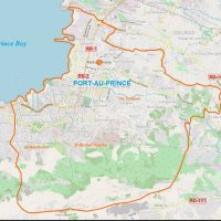
The commune of Port-au-Prince occupies an area of 36.04 km2 (14 Sq mi), and is located at the western end of the Cul-de-Sac plain at the end of Port-au-Prince bay, forming itself part of the Gulf of Gonâve. She is leaning on the Chaîne de la Selle mountains to the south where we find among others the wealthy suburb of Pétion-Ville. Port-au-Prince is traversed by some streams including the Bâtarde River and the ravine of Bois-de-Chêne.
The city itself is spread over 16 hills:
Saint-Martin
Sans-Fil
Bel Air
Canapé Vert
Bourdon
Fort National
Saint-Gerard
Turgeau
Pacot
Morne-à-Tuff
Poste-Marchand
Nazon
Bois-Verna
Bolosse
Nelhio
Fort Mercredi
Relationships between the City and the Outside: Port-au-Prince has always been a stratified city. It was once divided along lines of color and class, corresponding to the dividing line of the major metropolitan neighborhoods. This division is still evident as one moves from place to place in Port-au-Prince. The influx of Haitian peasants from the provinces is increased the heterogeneity ( the quality or state of being diverse in character or content) of these neighborhoods, as the result mainly of squatting and the rapid construction of poor housing in alleys and in largely deserted commercial areas. Now the city is the home of the poor, while the wealthy live in the suburbs higher up in the mountains, particularly in Pétion-Ville, Thomassin, and Fermathe. Interestingly, the Haitian poor refer to their places of residence in the city as “down here” and the places of residence of the more well-to-do as “up there”, a phraseology that reinforces the strict class separation that has been named “class apartheid”.
Because Port-au-Prince is bordered on the west by the ocean and on the east by steep mountains, it’s physical growth is limited and it is thus increasingly unable to accommodate its mushrooming population. The massive surge in population density has led to a decline in the provision of services by the municipal government.
As the capital of Haiti, Port-au-Prince the center of all domestic and international activities. It is the most important city in Haiti, followed by Cap-Haïtien. It is the seat of all governmental and diplomatic operations, as well as the locus of most nongovernmental and missionary endeavors in the country. In effect, Port-au-Prince mediates the majority of formal, informal, and development activities that occur. The largest airport in Haiti is on the outskirts of Port-au-Prince, making the city the first and last location that many travelers see. The airport has been on and off the U.S. Department of State’s list of dangerous travel locations for many years, owing to poor security and concerns over air safety. And the turn of the 21st century (2000s), the airport was not on that list, but it’s ominous reputation has remained. The notoriety of the Port-au-Prince airport is only one facet of the largely negative opinion that many people have about the city itself. As a result of Haiti’s bad press, most individuals who have never visited Port-au-Prince expect a near-military state filled with homeless, extremely poor individuals infected with HIV (human immunodeficiency virus). Most Americans, even members of the American military, consider Port-au-Prince to be a dangerous city. Inhabitants of the city also recognize the extreme perils it presents, scrambling to be away from the downtown areas before dark falls and safety becomes harder to ensure. As time progresses, at the municipal government is unable to maintain infrastructure and security, the reality will soon meet the reputation. Ironically, most residents are fiercely loyal to their neighborhoods: while characterizing their own city as a dangerous place where crime and violence are common, each neighborhood is considered safe and protective of its inhabitants.
Major Languages: Haiti’s major languages are French, Haitian Creole, and increasingly English. French and Creole share the title of official national language, as specified in the 1987 constitution. In the past, French was used as the official language for political and formal interactions. But since 7% or less of the population spoke French, this seriously restricted access to activities in the formal sector. Jean-Bertrand Aristide changed the constitution after becoming president in 1991, making Creole the official language of state. English is increasingly spoken in Port-au-Prince because of the presence of American dignitaries and military. Trade and migration have also encouraged the use of English in the city.
Climate: Regarding temperatures, they are regular all year round with an average annual temperature of 26.5 ° C (80F). The regularity of warm temperatures throughout the year is characteristic of tropical climates. Rainfall is relatively high, with an average of 51 inches per year. This average is slightly lower than the average rainfall in the country. This is explained by the location of Port-au-Prince in the Cul-de-Sac Plain, which experiences a much drier climate. Nevertheless, proximity to the ocean tends to soften temperatures by refreshing the air temperature. Port-au-Prince therefore benefits from a maritime influence.
In Port-au-Prince, 2 peaks of precipitation are observed, April-May then from August to October. Climatic analysis is important to understand the water course of rivers.
Culture: The non-profit Haiti Jazz, in collaboration with Caracoli and Haiti Music, came together to launch the new media library in Downtown Port-au-Prince recently. The House of Music (kay mizik la in Créole) was built as an archival storage space to house collections of Haiti’s music history, its recordings, documented history, and music artifacts.
The European Union (EU) has subsidized the project. The motivation to create the media library was to develop awareness, knowledge, and appreciation of Haiti’s cultural contribution to music arts. The EU’s Cultural Secretary, Leandro Medeot, on hand at the launch, commented on the importance of developing and carrying forward the artistic and social influences of Haitian music. The House of Music will provide a forum for music industry artists, musicologists, and technology specialists to gather, share, explore, and define the evolution and impact of Haitian music on the cultural landscape.
The House of Music will offer music lovers the entire catalog of Haitian music, books on its history, and music artifacts. The modest yearly fee the House of Music plans to charge will be used to maintain staff and upkeep of the facility.
Director of Haiti Jazz, Milena Sandler, envisions a space where music professionals will hold education programs, panel discussions, seminars, and performances. She acknowledges the library budget is limited and “that all holders of works of the Haitian musical heritage will agree to share them with us, so that we can make them available to the public.”
Infrastructure: The infrastructure of Port-au-Prince is considered by many to be non-existent. The municipal and state presence that should be evident in such a large political center is almost invisible. Economic researchers suggest that municipal services and urban management in Port-au-Prince have failed, owing to the burgeoning ranks of rural migrants. Many of these migrants have no knowledge of municipal institutions that should be providing services, much less which services are being provided. Infrastructural changes, particularly improvement of service delivery, public health, and security, and have been recommended to improve the conditions of life in Haiti’s capital city. Unfortunately, new municipal structures have not replaced the deteriorating structures that can no longer support contemporary Port-au-Prince.
Public Buildings, Public Works, and Residences: All offices for the government of Port-au-Prince and of Haiti are located within the boundaries of the city. Of primary importance are the National Palace, the Legislative palace, and the Judicial Palace, which house the major national offices. The national magistrates, the national prison, and the remaining national offices are also located downtown. The offices of the city government of Port-au-Prince are situated in the same area, housed mostly in the Hôtel-de-Ville (City Hall). The bureaus of tourism and commerce are in the historic district, as are the headquarters of the National Bank of Haiti and of the public services. Port-au-Prince boasts several large parks; the most important of these is the Champs de Mars, flanked by the principal national offices. Diplomatic offices, bureaus, and ministries are scattered throughout the city, usually occupying large homes.
Homes in the city vary in style and in level of comfort. Some houses, particularly in the older areas, are large Victorian-style residences made of wood. Others are more modern, built of concrete, brick, and stone. Walls and gates surround most homes for privacy and protection; many of the fences are topped with razor wire or with shards of broken glass embedded in cement. In poorer neighborhoods, most dwellings are constructed from concrete blocks or tin. In the poorest neighborhoods, the houses may even be fashioned from plywood or cardboard. Because of the rapid growth of the city, dwellings that were originally temporary have become permanent, lending the city the appearance of a slum. Nearly all neighborhoods have a local boutique, where water and basic supplies are sold. Street merchants provide for the remainder of most citizens’ needs.
Politics and City Services: Haiti is divided into ten departments, which are subdivided into arrondissements and communes. Port-au-Prince lies in the department of the West, and in the arrondissement and commune of Port-au-Prince. The offices of the mayor govern the city, but if the opinions of the citizens are correct, there is very little activity associated with the offices of the municipal government. The post office, library, courthouse, Chamber of Commerce, and most other municipal agencies are located in Downtown Port-au-Prince. Because of problems with delivery of services at a national level, most service providers are now private; telephone and electricity services have been privatized, with little improvement.
Education: The educational system of Port-au-Prince is based on the system of Catholic education that has been in place since the colonial era. There are both public and private institutions, with the latter using French as the language of instruction. There are some private schools that provide English-language education, attended mainly by the children of dignitaries or by Haitian-American children whose parents refer that they be taught English. Although schooling is free, books, supplies, and uniforms are not and must be provided for each child.
Because Haitians hold education with high regard, parents shoulder the expense of sending their children to school for as long as possible. There is massive overcrowding in the schools of Port-au-Prince. In the afternoon, as students are released from school, their brightly colored uniforms fill the streets. Traffic that arises from the rush of children at three o’clock leads most Haitians who transact business in the city to finish their affairs before they get caught in the rush.
Public schools in Haiti now teach in Haitian Creole, the native language of all Haitians, but this was not always the case. Because of the French colonial influence, classes were in French in a covered topics ranging from French history ti matrix algebra. The structure of the school system is similar to that of the French system, with several years in lower school and then in intermediate school and finally five years in upper school. At the end of the school program each year students take exit exams, which stress memorization and rote repetition over problem-solving and critical-thinking skills.
Evaluations of the educational system suggest that it is lacking in the provision of most skills. High rates of attrition and poor attendance lead to low academic performance in Port-au-Prince schools. Particularly for schools that service children of the lower socioeconomic groups, educational opportunities may be affected by the need to work to meet a family’s daily needs.
The premier university in Haiti is located in Port-au-Prince. The State University of Haiti and it’s accompanying medical, dental, and law schools are situated near the National Palace. Experts who have assessed the university system have concluded that improvements should be made in course content and in administrative structure to make the university a successful institution again.
The Ministry of the National Youth and Sports Education is headquartered in Port-au-Prince as well as the various offices involved in the management of other offices and annexes of the Department or the entire country. Over 200 private Kindergarten were inventoried. At the primary level, twenty six public and dozens of private and congregational schools were inventoried. Fourteen public high schools, numerous private, and six Congregational were also listed.
Health: The Ministry of Public Health and Population is headquartered in Port-au-Prince. With regard to the health facilities and staff attached to the latter, a high concentration was observed at the level of the commune in relation to the other municipalities in the country. Hundreds of doctors, dentists, nurses, and auxiliaries were counted in the health facilities of the commune.
Utilities: With regard to the availability of water, in addition to the drinking water supply network that hardly covers the commune, there is currently a number of Community fountains (28) at the neighbourhood level that allow people to feed a little more Easily in drinking water. Most of the commune of Port-au-Prince is electrified.
Sewage: Chicago and Port-au-Prince were both founded by men of Haitian descent, but that is where their similarity ends. Chicago built its own underground sewer system for both waste water and storm water back in the 1856. Port-au-Prince, one of the largest cities of million people, has no sewer system. It is noteworthy to mention that just 4 years ago, the country faced the worst epidemic of cholera in recent history; more than a half-million people have gotten sick and the disease took the lives of more than 8,231 Haitians. The cumulative sewage and garbage of over 3 million people flows through open ditch. Every night, few ‘bayakou’ workers remove the cesspools that collect deep bogs of human waste from man-sized holes (fifty-cubic-metre) under Haiti’s backyard latrines and dumped them into the city canals. During the rain, these wastes spill over the city environment before going to the sea. People living seaside, use over-the-sea hanging toilets and during emergency, they use some sort of plastic bag and throw the dirt out on the streets.
The U.N. senior coordinator for cholera response in Haiti has estimated that the building of a nationwide water and sanitation infrastructure would cost around $1.6 billion. But Haiti certainly can’t afford to undertake such projects, and the international community does not seem very willing to help. A national project is very much needed to tackle the challenges of sewage in Haiti that will protect the public against certain preventable diseases, create many necessary employment and countless new jobs and a decent living condition will contribute towards the development of tourism in the country to give the country the much needed economic boost. The authorities must make clear what they really mean by reconstruction when there is no plan to deal with raw sewage, and there is no access to clean water for the average Haitian.
Security: In terms of Administrative and judicial infrastructures, the commune of Port-au-Prince has several police offices (including commissariats and substations), including the Ministry of Justice, the courthouse, the peace courts and state offices Mainly in sections (North, southeast, etc.) following the place where they are located in the commune.
Transportation: Despite Port-au-Prince’s heavy reliance on non-motorized forms of transport, streets are a defining feature of the city. Port-au-Prince Metropolitan Area’s street grid plan greatly influenced the city’s physical development. Several of the city’s streets and avenues, like Delmas 2, are also used in planning. In addition, many roads in the municipality become impassible after rain storms, when water and mud fill the streets.
Public transportation exists in the form of taptaps, converted pickup trucks or minibuses that run regular routes for a small fare. Taptaps are usually very colorful painted trucks whose beds have been converted into covered seating. Most of these vehicles are named, and citizens of Port-au-Prince often have preferences for which they choose to take from one destination to another. Taptaps connect all of the major neighborhoods with one why they each other, tie in the suburbs with the rest of the city, and link the city with the rest of Haiti to some degree. They are an informal-sector response to a municipal need, serving at the primary mode of transportation for many Haitians. In addition, they carry agricultural and other goods to the markets in Port-au-Prince, supporting the largest and most important economic activity in the country.
Religion: Nearly 173 temples (cathedrals, churches, chapels and resorts included) were counted in the commune. A diversified number of religions have been identified in the commune, the names of the latter vary depending on the mission or the person in charge.
Organization: Forty-three Political parties have representation in the commune. Ten Popular organizations, women’s groups, twelve NGOs and eighteen international organizations were also inventoried in the municipality.
Communication: In the area of the telephone, the municipality has an administrative office, a telephone exchange and several ancillary offices distributed almost throughout the municipality. In addition to the Central postal office and its annexes, the municipality benefits from the service of at least ten other private institutions occupying the mail coming mainly from abroad. In addition, fifteen radio stations, eleven magazines/newspapers and two television stations were also listed in the municipality.
Leisure: As for leisure, the commune of Port-au-Prince has ten libraries, three cinemas, two theatre halls, and two museums. The sports are football (soccer), volleyball, basketball, tennis, athletics, and martial arts. For monuments and sites, they are mostly of historical type. The commune of Port-au-Prince is one of the communes that has the most public squares. There are about twenty scattered in most of the commune with a high concentration going from the Champ de Mars to the level of the National Palace.
Haiti’s #1 Search Engine
Categories
Recent Posts
Archives
Recent Comments
Meta